


Article
n° 5 novembre 2014 : La géographie de l'époque napoléonienne:
Varia: Regional geography goes serial – current trends in providing regional geography to the general public in Germany
Haik Thomas Porada
Dr. Haik Thomas Porada, M.A.
Leibniz-Institut für Länderkunde e.V.
Schongauerstraße 9, 04328 Leipzig
E-Post: H_Porada@ifl-leipzig.de, Internet: www.ifl-leipzig.de
Abstract: Due to Germany’s structure as a union of federal states (the Länder), inventory projects to systematically collect and compile geographical information on a specific region have mostly been tied to the federal states or their political predecessors. Also within the academic tradition, Landeskunde or Regional Geography is a uniquely German concept. The independence of the German federal states in matters of culture and education results in great differences in the way that elements of cultural landscape are documented. These start with how the concept of cultural landscape (Kulturlandschaft) is defined and end with the organizational affiliation of the individual inventorying projects. For this reason, it is not only impossible to propose a thesis that would apply to the whole of Germany, comparisons are also difficult. Nevertheless, we will have a closer look at the origins of three inventorying projects in this paper.
Key words: regional documentation, cultural landscapes, federal state
The independence of the German federal states in matters of culture and education results in great differences in the way that elements of cultural landscape are documented. These start with how the concept of cultural landscape (Kulturlandschaft) is defined and end with the organizational affiliation of the individual inventorying projects. For this reason, it is not only impossible to propose a thesis that would apply to the whole of Germany, comparisons are also difficult.[1] Nevertheless, we will have a closer look at the origins of three inventorying projects in this paper. They each have a rich history, were initiated by and receive institutional support from geographers, and feature interdisciplinary working methods.
The three regional studies series will be compared in terms of aims, methodological approach and results: “Kreisbeschreibungen des Landes Baden-Württemberg” [Descriptions of Districts in the Federal State of Baden-Württemberg] published by the State Archive of Baden-Württemberg in Stuttgart; “Städte und Gemeinden in Westfalen” [Towns and Municipalities in Westphalia] published by the Geographical Commission for Westphalia in Münster; and “Landschaften in Deutschland – Werte der deutschen Heimat” [Landscapes in Germany – Values of the German Home] published by the Leibniz Institute of Regional Geography and the Saxon Academy of Sciences at Leipzig (figure 1).
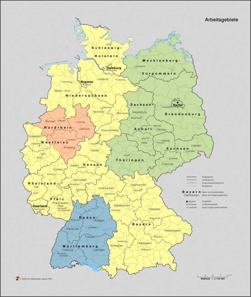
Fig. 1
Series of regional studies that would cover the entire nation-state were conducted only in West Germany and only until the 1980s. Based on the national German topographic map (scale 1:50,000), the project was run by a “Zentralausschuß für deutsche Landeskunde” – the Central Committee for German Regional Geography Studies, since 1996 called the Deutsche Akademie für Landeskunde (DAL), the German Academy for Regional Geography. While the Central Committee was closely affiliated to Trier University and funded by the German government, the DAL is a rather loose association of scholars. The DAL moreover publishes a well-known publications series and a scholarly journal. Today, there is no nation-wide project of regional geography studies anymore.
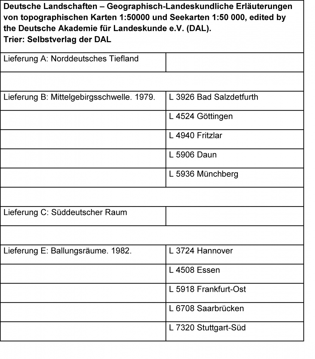
Table 1
Due to Germany’s structure as a union of federal states (the Länder), inventory projects to systematically collect and compile geographical information on a specific region have mostly been tied to the federal states or their political predecessors. Also within the academic tradition, Landeskunde or Regional Geography is a uniquely German concept (Wardenga, 2013). First volumes on regional geography appeared in German countries in the Early Modern Era, yet the concept of Landeskunde fully emerged only in the late 19th century (Harder, 1983). It had its heyday in the federal states and Prussian provinces of the German Reich around 1900. In the 1920s and 1930s, several large-scale regional studies series were initiated, some of which continued even after World War II (Reinhard, 1999). One of these is the Leipzig project, which will be described in more detail below.
After World War II almost all West German federal states started their own geographical inventory projects, usually based on the structure of the municipal district. Today the majority of them have been abandoned. In Baden-Württemberg, a federal state with a long-standing tradition of high-quality regional geography, one ambitious large-scale project continued well into the past decade. The geographers and historians to describe the entire state, district by district, were employed by the Federal State Archives at the capital of Stuttgart. The archive in turn had several branch offices connected to other federal archives all over Baden-Württemberg. Headed by geographers, around thirty people worked for the Baden-Württemberg Kreisbeschreibung (Regional Description) until the end of the 1990s. The project still had fifteen employees when it was closed down in 2009. The origins of this inventory of regional studies can be traced back as far as the Early Modern Period; the institution itself dates back to the 18th century. Generally the Baden-Württemberg Kreisbeschreibung gave a very balanced description of both urban and rural regional geography and development (Reinhard, 1999).
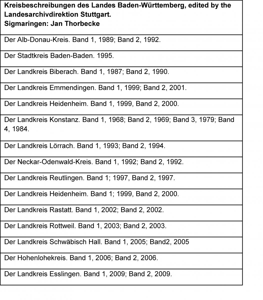
Table 2
The federal state of North Rhine-Westphalia greatly differs from Baden-Württemberg, where the regional studies volumes were state-run. Both former Prussian provinces – Westphalia and the Rhine – had a strong tradition of communal self-government. The administrative body of the Provinzialverband, the provincial assembly, was the governing body above the local community and below the Prussian province government. Until today the Landschaftsverband – regional authority – is a central governing body both in the Rhenish and the Westphalian regions.[2] Seat of the Westphalian regional authority is Münster, where the Geographical Commission of Westphalia has its seat as well and has been publishing the “Cities and communities in Westphalia” for almost 20 years now. Much like in Baden-Württemberg, the regional studies series was structured according to the municipal districts created in the West German communal restructuring of the late 1960s and early 1970s. District by district, the permanent staff of about ten scholars systematically covered the entire region, describing cities, towns and villages. The series focused on the current state of things, mapping the use of lands and completing it with bird’s eye views in color. Unlike its southwestern German equivalent, the series included no historical genesis of settlement patterns or in-depth discussion of land use, to say nothing of archaeological insights (Heineberg, 2007).
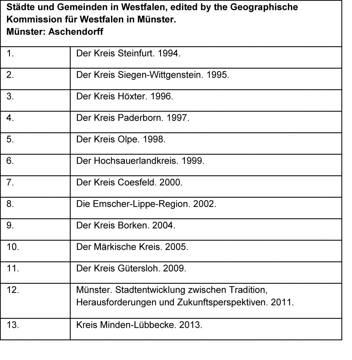
Table 3
The strong stand of Heimatbewegung in Saxony, but also in Thuringia and Saxony-Anhalt, made itself felt even after 1945. In the Soviet Occupation Zone and later the German Democratic Republic, university geographers worked on reviving the regional inventorization project of the pre-war years. Thus in the 1950s they managed to win the Academy of Sciences over and consequently the Dresden Commission for Local Research (Heimatforschung) was affiliated with the Berlin Academy. Yet in the meantime the historical structure of federal states had been abandoned by the GDR authorities in favor of ahistorical “districts”, and the region to cover could, for political reasons, not be called “Saxony” anymore. Moreover the project was extended to cover all of the GDR territory. Initially the editors even thought pan-German, with a possible future German re-unification under Communist or pseudo-neutral auspices in mind. Yet this did not change the main principle of the volumes: A complete inventorization of all geographical features of a specific area, based on a section of the topographic map on a scale of 1:25,000. In 1957, the first volume was published, covering a part of Saxon Switzerland, more precisely the Elbe valley south-east of Dresden. This was the first regular volume of “Values of the German Home” (Werte der deutschen Heimat). The series has been continued in rapid sequence, with 72 volumes so far. For political reasons, it had to change its title to “Values of our Home” in 1971 (Grundmann, 1994).The third systematic series of regional geography in Germany is the Leipzig one. The Saxon Inventory of Regional Geography, based in Leipzig, was originally initiated by the Saxon Teachers’ Union in 1935. Its goal was to cover the geography of the entire region by measure of a Meßtischblatt each, the German topographic plane survey map sheets of 1:25,000 scale. The geographical inventory to each map sheet was supposed to be worked out by a teacher, ideally together with his pupils as part of the lessons. The results were to be printed as material for teaching local history and geography – the German Heimatkunde – at other schools. The project was realized with great energy: Before the end of World War II, all volumes had actually been completed. Yet only the one on the Annaberg region in the Erzgebirge (Ore Mountains) provisionally appeared in print. The scholarly foundation of this project was the Leipzig school of historical-geographic research. Since the late 19th century, notable under the historian and geographer Rudolf Kötzschke (1867-1949), Leipzig University had an outstanding expertise in this field for most of Central Europe. A second possible explanation for the enormous amount of research completed in the Saxon regional geography series is the strong position of the German Movement for the Preservation of Regional Landscape and Culture, the Heimatschutzbewegung, in the early 20th century. Three quarters of the nation-wide several ten thousand members lived in Saxony. This politically and culturally colorful movement flourished until its forced political assimilation – Gleichschaltung – in the Nazi years. The Saxon Movement for Preservation of Regional Landscape and Culture, the Sächsischer Landesverein Heimatschutz, was re-established in 1990 and today is an influential organization with over 20,000 members again (Brogiato and Porada, 2008).
Via the Academy of Sciences, after 1968 Academy of Sciences of the GDR, the project was affiliated with the Leipzig Institute for Geography and Geo-Ecology in 1969. This institute goes back to the Leipzig Museum for Comparative Regional Studies, founded in 1896 and later converted into the German Institute for Regional Studies. In 1992, this tradition was continued by founding the current Institute for Regional Geography (Institut für Länderkunde, short: IfL). As part of the Leibniz Scientific Community, the IfL is funded by the State of Saxony and the German federal government. Within the institute's department of cartography and visual communication, the Regional Inventorization is a separate field of research with currently one editor. The results are being published in the series „Landschaften in Deutschland – Werte der deutschen Heimat“ (Landscapes in Germany – Values of the German Home), the official title of the series since 2000, when the IfL became editor together with the Saxon Academy of Sciences (SAW) at Leipzig. In GDR times each volume sold 30,000 copies, often in several editions. The volumes were so popular because they were the only regional study series of its kind. Often these were the first scholarly descriptions of the respective regions, accepted and wide-spread both among scholars and average citizens, they often functioned as reference books in private households. Today’s print run numbers vary between two and three thousand for each volume. The series, now published by Böhlau (Cologne, Weimar, Vienna), still ranks among the most wide-spread regional geography series in Germany.
The regional inventorization practiced today at the Leipzig institute follows the model of an object-related or site-specific regional survey (Denecke and Porada, 2008a, 2008b, 2009; Denzer, Klotz and Porada 2011). This includes a full inventory of all current settlements of the given region, including abandoned ones, plus the so-called “Naturpunkte”, that are the geological, botanic and zoological regional specifics and typical features that shape the landscape. These are being located on the map (scale 1:25,000) and described in corresponding text chapters. An overview of the regional geography, based on the inventorization outlined above, completes the volumes. Appendices give statistic and chronological data on the region. Apart from illustrations, especially the thematic maps, diagrams and sections serve to explain the natural and cultural specifics of the region clearly and understandably (Schleinert, Fischer and Porada 2012). From fifteen to fifty authors currently work on each volume, covering the subject areas of geography, geology, geomorphology, hydrology, climate, botany, zoology, archeology, history, art and architectural history, language and dialectology, onomatology, as well as land use and regional planning (figure 2-6). As of today, ten volumes are under way, with a total of more than 300 authors, co-ordinated by the Leipzig editor (figure 7). The contributors are mostly university and academy scholars, but occasionally also municipal staff or hobby historians that have been researching their home towns for years. For each volume, it takes an average of three years to be published (figure 8).
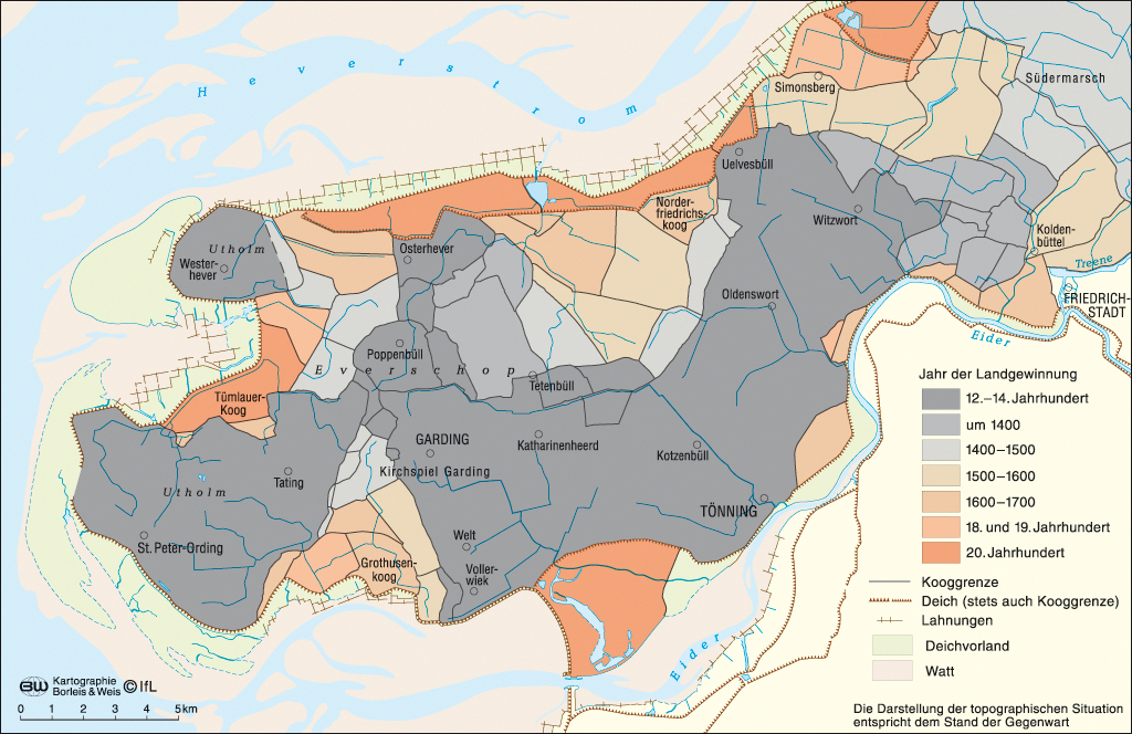
Fig. 2
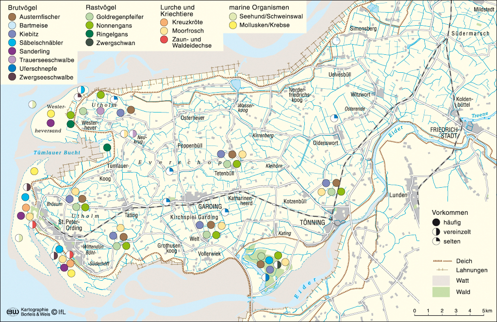
Fig. 3

Fig. 4
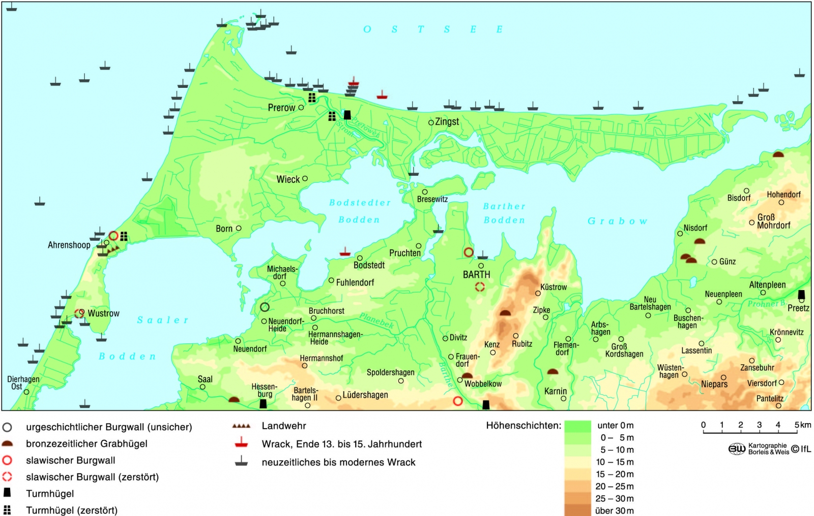
Fig. 5
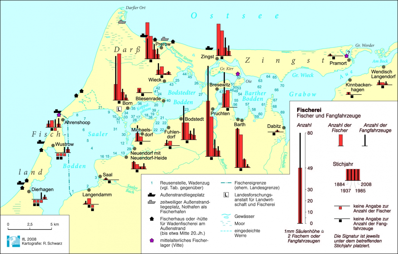
Fig.6
.jpg)
Fig. 7
.jpg)
Fig. 8
Reaching out to younger audiences is a special challenge for the projects outlined above – like those from Münster or Leipzig. Closely connected to this is the question of going online or developing mobile apps. The Geographical Commission for Westphalia together with education experts started an initiative for schools already in 2007, headed “Westphalia Regional” (Heineberg, 2007 and 2010). Since fall 2012, the editors of the “Landscapes in Germany” series with their academic advisory council and the Cologne publishing house have discussed how to carry the project into digital age. As one result, the interactive "Landscapes of Germany"-website will be presented at the Leipzig Book Fair in March 2015.
Figures
Figure 1: The three regional studies series: Blue: Kreisbeschreibungen des Landes Baden-Württemberg [Descriptions of Districts in the Federal State of Baden-Württemberg], Red: Städte und Gemeinden in Westfalen [Towns and Municipalities in Westphalia], Green: Landschaften in Deutschland – Werte der deutschen Heimat [Landscapes in Germany – Values of the German Home]
Figure 2-6: Selected examples of figures from the volumes 71 and 72 of "Landscapes of Germany".
Figure 7: Institutional affiliation of the authors of "Landscapes of Germany" over the last 15 years.
Figure 8: Overview of the published or currently in progress volumes of "Landscapes in Germany" between 1957 and 2014.
Literature
Brogiato H.P. and Porada H.Th., 2008, Das Leibniz-Institut für Länderkunde in Leipzig – Ein geographisches Forschungsinstitut mit Tradition, in: Jahrbuch für Geschichte Mittel- und Ostdeutschlands – Zeitschrift für vergleichende und preußische Landesgeschichte, Jg. 53, p. 243-292.
Denecke D. und Porada H.Th., (Ed.), 2008a, Der ländliche Siedlungsraum, als Themenheft hg. von (= Berichte zur deutschen Landeskunde, Band 82, Heft 1). Leipzig, 53 p.
Denecke D. und Porada H.Th., (Ed.), 2008b, Die Darstellung von Städten im Rahmen einer landeskundlichen Erfassung und Übersicht. 50 Jahre „Landschaften in Deutschland – Werte der deutschen Heimat“ (= forum ifl 9). Leipzig. 85 p.
Denecke D. und Porada H.Th. (Ed.), 2009, Die Erfassung und Darstellung von Siedlungsraum, Siedlung und Bausubstanz in der landeskundlichen Bestandsaufnahme, hg. von Dietrich Denecke und Haik Thomas Porada (= forum ifl 12). Leipzig, 144 p.
Denzer V., Dietrich A., Hardt M., Porada H.Th. and Schenk W. (Ed.), 2011, Homogenisierung und Diversifizierung von Kulturlandschaften (= Siedlungsforschung 29). Bonn, 430 p.
Denzer V., Klotz St. and Porada H.Th. (Ed.), 2011, Die historisch-landeskundliche Bestandsaufnahme und Darstellung von Gewässern und Gewässernutzungen (= forum ifl 15). Leipzig, 159 p.
Grundmann L., 1994, Die Buchreihe „Werte der deutschen Heimat“ – Bearbeitungsstand und Weiterführung, in: Sitzungsberichte der Sächsischen Akademie der Wissenschaften zu Leipzig, Mathematisch-Naturwissenschaftliche Reihe 124, H. 6, p. 81-95.
Harder H.-B. (Ed.), 1983, Landesbeschreibungen Mitteleuropas vom 15. bis 17. Jahrhundert. Vorträge der 2. Internationalen Tagung des „Slawenkomitees“ im Herder-Institut Marburg a.d. Lahn 10.-13. November 1980 (= Schriften des Komitees der Bundesrepublik Deutschland zur Förderung der Slawischen Studien, ed. by Rothe H., Band 5 – Association internationale pour l’étude et la diffusion des cultures slaves – UNESCO). Köln/Wien, 285 p.
Heineberg H. (Ed.), 2007, Westfalen regional [1]. Festgabe für Prof. Dr. Klaus Temlitz zum 65. Geburtstag von der Geographischen Kommission für Westfalen. Münster, 340 p.
Heineberg H. (Ed.), 2010, Westfalen regional (2). Hg. von der Geographischen Kommission für Westfalen. Münster, 322 p.
Porada H.Th., 2006, Die Neufassung des gesetzlichen Rahmens für die Kulturlandschaftspflege in Schweden und ihre Ausgestaltung in der Praxis, in Kulturlandschaften als Herausforderung für die Raumplanung. Verständnisse – Erfahrungen – Perspektiven, ed. by Matthiesen U., Danielzyk R., Heiland St. and Tzschaschel S. (= Forschungs- und Sitzungsberichte der Akademie für Raumforschung und Landesplanung, Band 228). Hannover, p. 242-252.
Reinhard E. (Ed.), 1999, Gemeindebeschreibungen und Ortschroniken in ihrer Bedeutung für die Landeskunde (= Werkhefte der Staatlichen Archivverwaltung Baden-Württemberg: Serie A, Landesarchivdirektion, Heft 12). Stuttgart, p. 19-32.
Renes H., 2013, Europäischer Vergleich methodischer Ansätze zur Erforschung der historischen Kulturlandschaft, in: Landeskunde, Environmental History, Landschaftsökologie, als Themenheft ed. by Vera Denzer, Stefan Klotz and Haik Thomas Porada (= Berichte. Geographie und Landeskunde, Band 87, Heft 3). Leipzig, p. 215-231.
Schleinert D., Fischer L. and Porada H.Th., 2012, Comparison of the development of agrarian landscapes based on regional inventories of the Southern Baltic Region and North Frisia, in: Latvijas Zinātņu Akadēmijas Vēstis, A daļa: humanitārās un sociālās zinātnes. Gads, 66. Sējums, 3. numurs: Proceedings of the 24th session of the Permanent European Conference for the Study of the Rural Landscape PECSRL: Living in Landscapes – Knowledge, Practice, Imagination. Riga, p. 78-92.
Wardenga U., 2013, Writing the history of geography: what we have learnt – and where to go next, Geographica Helvetica, 68, p. 27-35.
[1] Over the last years European countries with a lesser pronounced federal structures have been able to easily operate cross-border projects for the acquisition and maintenance of cultural landscapes e.g. the Netherlands or Sweden. Cf. Renes, 2013 for the respective traditions of the Netherlands in comparison to different European countries. For Sweden see also Porada, 2006.
[2] The provincial assembly (Provinzialverband) was bound to the Prussian provincial constitution and was repealed in 1945. The assignee of the provincial assembly – the today's landscape Association – is likely to be an outcome of the post-war development in the Federal Republic of Germany.